09 Dec Upper Iowa River Watershed – Iowa Geologic Survey Bureau Karst Survey

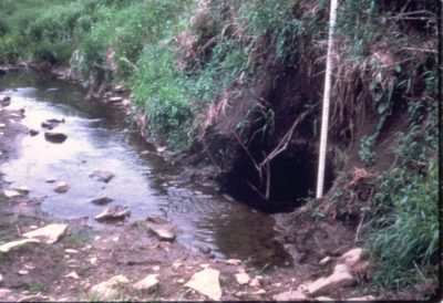
Instream Sinkhole
NE IA RC&D provided assistance to the Iowa Geologic Survey Bureau and other partners to conduct a karst survey in the Upper Iowa River Watershed over a three year period. The IGSB provided funding for RC&D Student Interns through a grant from the US Geologic Survey Bureau. NRCS partnered by providing GPS units and the RC&D provided supervision, office space, GIS assistance, equipment and supplies. Previous karst surveys in the Upper Iowa River watershed were completed in the 1960’s and early 1970’s. The project helped partners determine the best methods and practices for sinkhole identification on a landscape level. The project was important for resource professionals to help them manage programs, funding and technical assistance in a landscape where sinkhole morphology changes over time due to siltation and/or collapse. Although some sinkholes close naturally, many are filled or considerably altered by landowners, and new sinkholes develop. Various methods of identification were field verified to determine and fine tune the most accurate methods so that a complete and comprehensive karst database could be maintained with the state of Iowa.


